Orographic, Frontal (Cyclonic rainfall) and Convectional Rainfall: Features and Causes of Occurrence
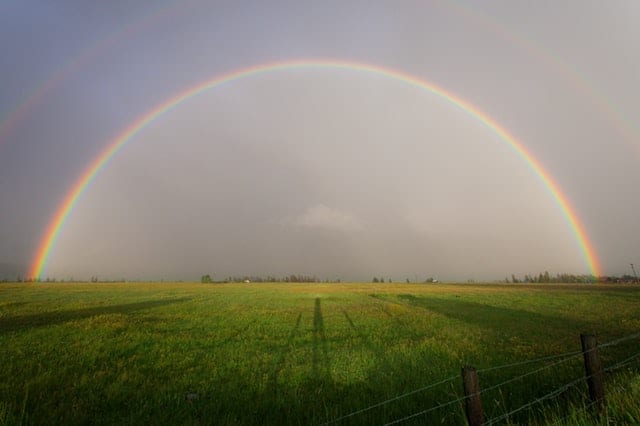
Rain is a beautiful thing, and it is a must for our survival. Without rain and water, no living beings can survive. How we get rain depends on the water cycle. Here is how the cycle goes:
- The entire process starts with the sea. First, seawater gets heated by the sun and evaporates. The seawater turns into water vapor and steam. As the hot air tends to be light, it rises upward.
- When the water vapor rises, it is cooled. The air cannot hold moisture as much as it could when it was warmer. The cold air reaches a point where it is 100% saturated, it becomes heavier, and it cannot hold any more water. This is called the dew point. Above this dew point condensation occurs.
- Condensation is a process in which the water vapor (a gas) held in the air is turned back into water droplets (a liquid), and fall as rain.
- This cooling turns the water vapor to condense, and as the vapor condenses, the cloud is formed. The cloud receives vapor until the point it can hardly store anymore. The cloud, therefore, being saturated begins to precipitate.
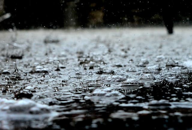
- Precipitation has many forms depending on temperature. It can be rainfall, Virage, drizzle, mist hailstones, sleet, or snowfall. The rain is the most common form.
- The rain or precipitation flows into rivers and streams, and these rivers and streams eventually flow into the sea where the cycle begins again.
Rainfall is of three different types namely – Orographic, Frontal (Cyclonic rainfall), and Convectional rainfall.
Orographic or Relief Rainfall and its Features
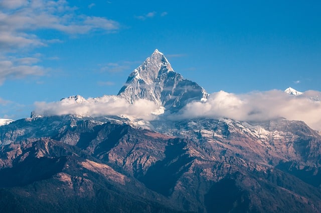
Relief rainfall occurs very frequently near mountains beside the sea because of the ascent of air forced by the mountain barrier. The preconditions are that there must be sufficient moisture in the air. The height of the mountain should be enough to block the moist incoming air, and this barrier should be across the wind direction that the moist air is forced by obstruction to rise upward.
Causes for Occurrence of Orographic or Relief Rainfall
- The moist wind blows in from the sea. As the wind gets obstructed by a high mountain, it rises upwards. As it rises upwards, it is cooled, and the cloud is formed.
- The cloud burdened with water vapor becomes saturated and begins to precipitate on the side of the seaside of the mountain, which is known as the windward side or slope.
- The main characteristic of this sort of rain is that the cloud precipitates the most on the mountain’s windward slopes. After giving a shower on the windward side, the cloud reaches the other side, they descend, and their temperature rises. By that time, the cloud has already lost most of its moisture and its capacity to take in moisture increases, and hence, these leeward slopes remain dry and rainless. The area on the leeward side gets less rainfall and is known as the Rainshadow.
- It is the reason why leeward sides or the Rainshadow area of a mountain are very sheltered from rain, and they do not get much rain.
- There is a moister climate on windward sides of slopes while the lee side of a mountainous area is much drier.
- The Descending Wind on the Leeward Side is heated adiabatically and is known as Katabatic Wind.
This type of rainfall is widespread in Hawaii, Sierra Nevada, the Andes, Patagonian desert in Argentina, and Eastern slopes of Western Ghats. In the state of Rajasthan, India, as the highly moist air coming from the Arabian Sea does not get obstructed by the Aravalli, it doesn’t play a vital role in rainfalls. It is, therefore, a dry rain shadow area on the lee side of a mountainous area. The mountains block the passage of weather systems that produce rain, casting a “shadow” of dryness behind them.
In south India, the Mangalore gets 2000 mm of rainfall being located on the western windward slope. However, Bangalore falls in the rain shadow area and receives less than 500 mm of rainfall. Similarly, Mahabaleshwar, situated on the Western Ghats, receives 600 cm and more of rainfall, whereas Pune, lying in the rain shadow area, receives only about 70 cm rainfall.
Frontal (Cyclonic) Rainfall and its Features
This occurs due to the convergence of different air masses with different temperatures, density, and humidity. The turbulent conditions are produced, and cyclonic rain occurs along the fronts of the cyclone. The layer separating them is known as a front. The front has two parts – the warm front and the cold front.
At the warm front, the lighter warm air that is less dense usually forced to rise over denser cold air and thereby leading to cyclonic rain. A variety of clouds get formed, and they generally lead to moderate to heavy rainfall.
Causes for Occurrence of Frontal Rainfall
- A tropical warm air mass comes in contact with a cold air mass of polar region. The less-dense, lighter warm air is then forced to rise over the denser, cold air.
- It causes warm air to become cold. As the warm air is forced to rise further, it condenses to form the stratus cloud.
- After becoming saturated, the stratus cloud begins to precipitate.
- Frontal or cyclonic rain falls gradually for a few hours which can also extend up to a few days.
It is prevalent in Britain and Ireland, which is associated with the movement of depressions over the country. In north-west Europe, warm oceanic air and cold continental air converge to produce heavy rainfall in adjacent areas.
Convectional Rainfall and its Features
This type of rainfall is very common in summer in tropical or equatorial regions where it is very hot, and the ground is heated by the sun. The preconditions for this kind of rainfall are intense heating of the ground surface by incoming shortwave electromagnetic solar radiation and ample supply of moisture caused by evaporation to the air to result in high relative humidity.
Convectional rain frequently occurs in the afternoon on hot days with thundery showers from cumulus or cumulonimbus cloud. This rainfall variant is heavy but of short duration. It is highly localized, and a minimum amount of cloudiness occurs.
Causes for Occurrence of Convectional Rainfall
- The sun heats the ground; the air warms up and becomes very hot.
- The hot air becomes light and rises upwards. As it rises, it expands, loses heat, and the air is cooled and condenses, forming cumulus cloud.
- This process releases the latent heat of condensation, which further heats the air, and the air is forced to go up further.
- When the cumulus cloud is saturated, it begins to precipitate with heavy and thundery showers.
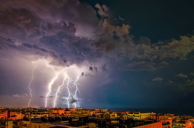
- Convection usually produces towering cumulonimbus clouds that produce heavy rain with thunder and lightning.
- It is primarily the reason for getting thundery showers on a hot day
This type of precipitation is common over equatorial doldrums in the Congo Basin, the basin of Amazon and the south-east Asian islands. The internal parts of the continents, mainly the northern hemisphere, usually receive this type of rainfall.
References:
https://www.projectgcse.co.uk/gcse_geography/types_of_rainfall
https://byjus.com/free-ias-prep/ncert-notes-geography-types-of-rainfall/